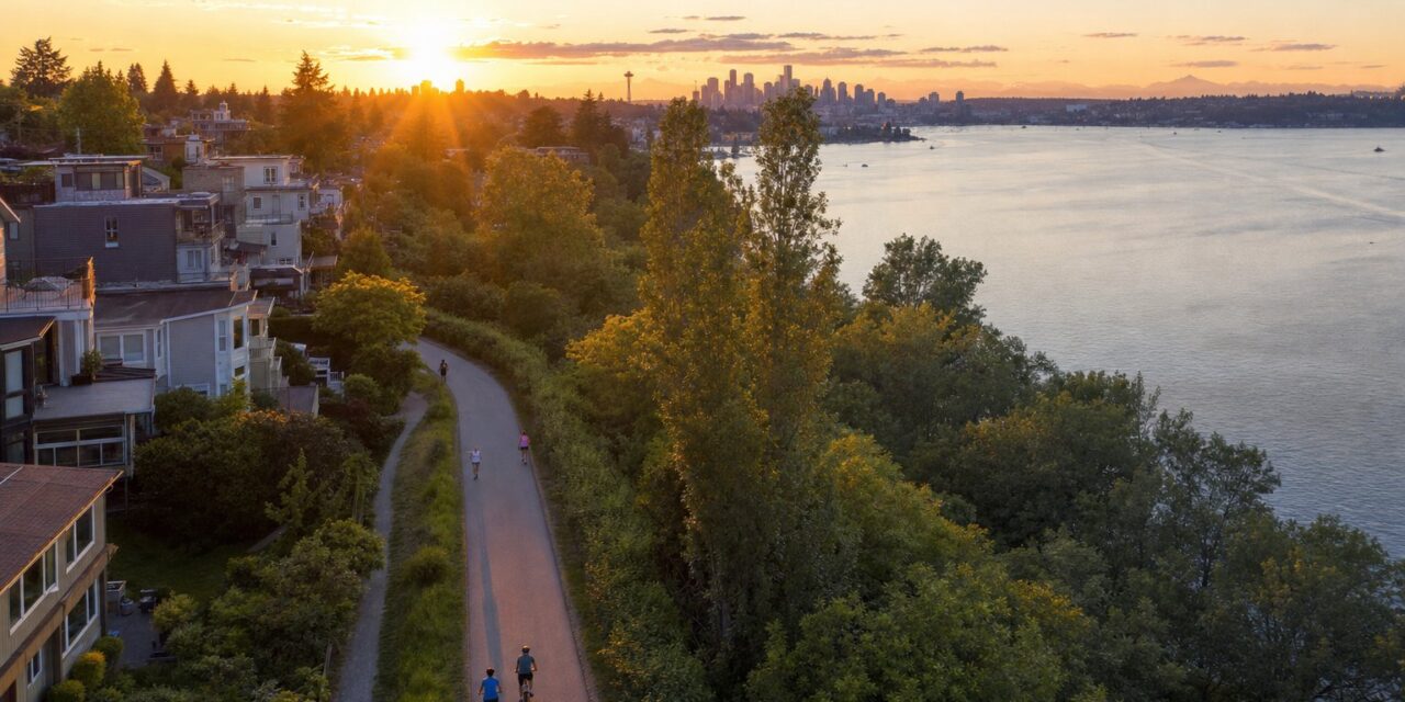
Burke Gilman Trail Overview and Route Basics
The Burke Gilman Trail stretches 27 miles through the heart of Seattle’s north side, connecting Ballard to Bothell through some of the region’s most vibrant neighborhoods. This multi-use trail follows the historic Seattle, Lake Shore and Eastern Railway corridor, offering cyclists, runners, and walkers a car-free route through urban parks, lakefront views, and bustling commercial districts. The trail surface varies from smooth asphalt to crushed gravel, with most sections featuring well-maintained pavement suitable for road bikes, mountain bikes, and running shoes.
Originally opened in segments throughout the 1970s and 1980s, the Burke Gilman Trail has become one of the Pacific Northwest’s most popular recreational corridors. The western terminus begins at the Ballard Locks, where you can watch salmon runs and boats navigate between Puget Sound and Lake Union. From there, the trail winds eastward through Fremont, Wallingford, the University District, and along Lake Washington’s northern shore before reaching its eastern endpoint in Bothell. Weekend traffic can be heavy, particularly on sunny days, so early morning or weekday rides offer the most peaceful experience.
Major Access Points and Parking Options
Key access points along the Burke Gilman Trail include the Ballard Locks (free parking available), Gas Works Park in Wallingford (limited street parking), and the University of Washington campus near Husky Stadium (pay parking in campus lots). The Matthews Beach Park access point offers ample free parking and restroom facilities, making it popular with families and groups. For those starting from the eastern end, Bothell Landing provides free parking and connects directly to the Sammamish River Trail for extended riding options. Each major access point features trail maps and basic amenities, though water fountains and restrooms are more common at park locations than street-level entry points.
Trail Surface Conditions and What to Expect
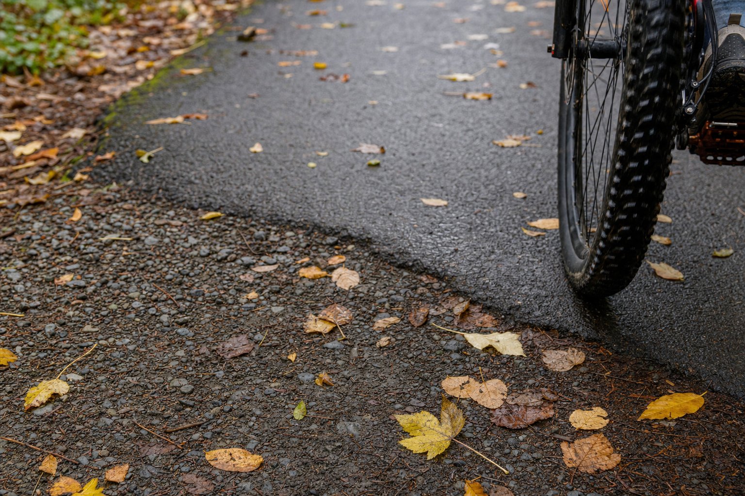
The Burke Gilman Trail surface quality varies significantly by section, with the newest portions featuring smooth asphalt while older segments include packed gravel and occasional rough patches. The Ballard to Fremont section runs on mostly paved surfaces with some brick and concrete transitions through industrial areas. From Fremont through the University District, expect consistent asphalt with good sight lines and minimal elevation changes. The trail’s most challenging section runs from Sand Point to Bothell, where tree roots have created uneven pavement and several short detours route users onto city streets.
Weather impacts trail conditions throughout the year, with fall and winter bringing wet leaves that create slippery surfaces, particularly on the many wooden bridges spanning creeks and ravines. Spring often reveals winter damage including potholes and debris, though Seattle Parks Department typically completes major repairs by May. Summer offers the best riding conditions, though increased foot traffic and occasional construction projects can slow progress. Cyclists should carry basic repair tools, as bike shops are limited along the eastern portions of the trail, with the nearest full-service shops located in the University District and Bothell.
Seasonal Considerations and Weather Impacts
Pacific Northwest weather significantly affects Burke Gilman Trail conditions, with winter storms occasionally closing sections due to fallen trees or flooding near creek crossings. The trail’s proximity to Lake Washington moderates temperatures but increases humidity, creating morning fog that can reduce visibility during cooler months. Rain creates the most challenging conditions, as the trail’s many painted lane markings become extremely slippery when wet. Experienced local users recommend avoiding the trail during heavy rain events, when drainage systems can overflow and create standing water, particularly in the lower-elevation sections near the University District.
Neighborhood Highlights and Points of Interest
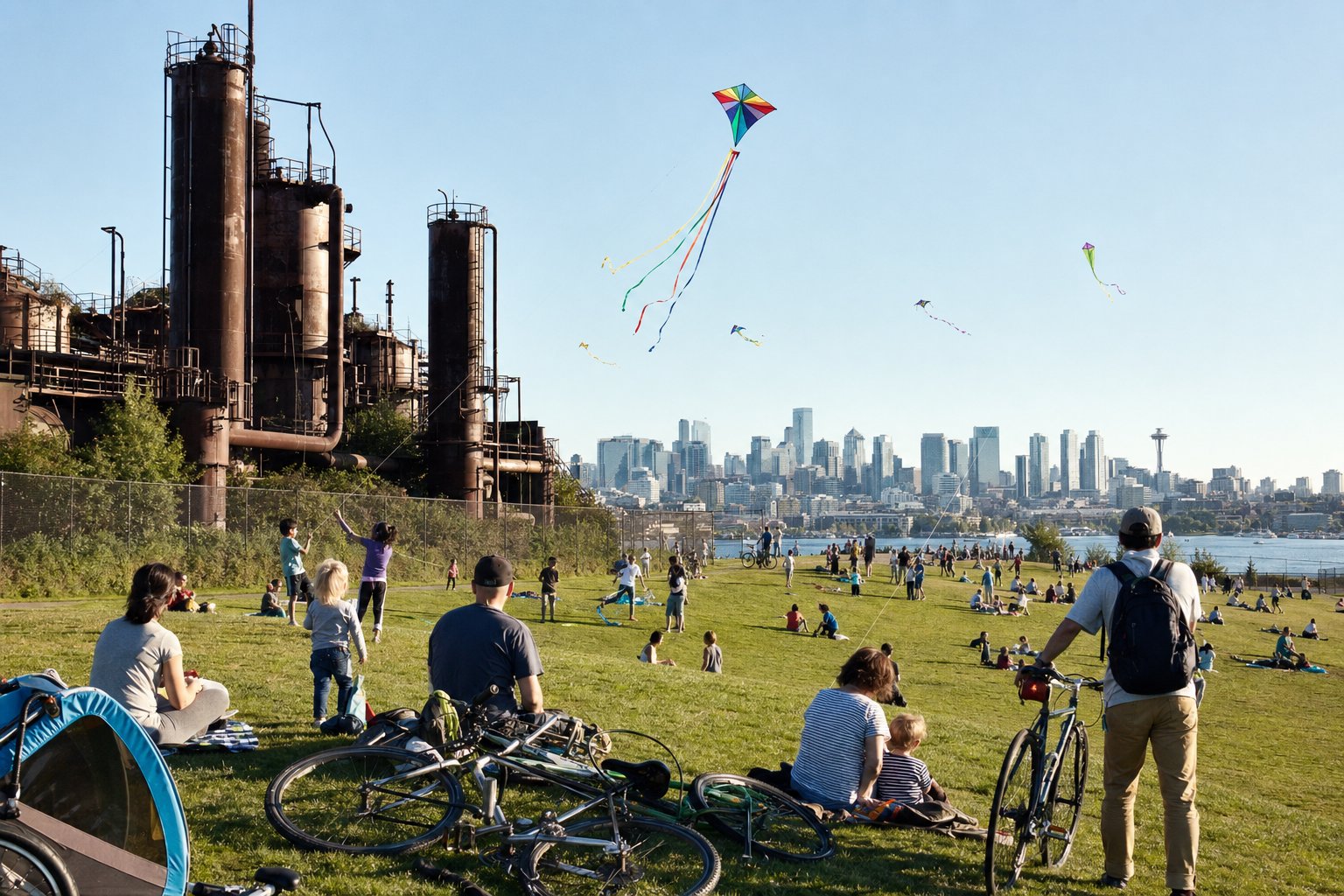
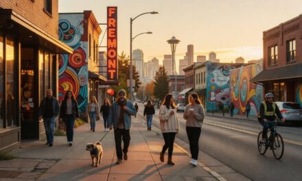
The Burke Gilman Trail passes through some of Seattle’s most distinctive neighborhoods, each offering unique attractions and stopping points. Ballard’s maritime heritage shines at the Hiram M. Chittenden Locks, where visitors can watch boats navigate the ship canal and salmon climb fish ladders during spawning season. Fremont brings quirky public art including the famous Fremont Troll under the Aurora Bridge and numerous local breweries within walking distance of the trail. The University District section provides easy access to campus attractions, farmers markets, and diverse dining options along 45th Street.
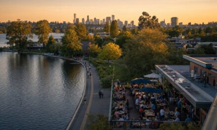
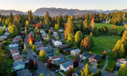
Gas Works Park offers one of Seattle’s best skyline views and serves as a popular picnic destination, though the steep climb from trail level to the park’s summit challenges casual cyclists. The eastern sections reveal Lake Washington’s natural beauty, with several beaches and parks providing swimming opportunities during summer months. Matthews Beach Park features a large swimming area, playground equipment, and seasonal concessions. As the trail approaches Bothell, it transitions from urban to suburban character, passing through wetlands and offering glimpses of the Cascade Mountains on clear days.
Food and Refreshment Stops Along the Route
Strategic food stops make the Burke Gilman Trail ideal for longer recreational outings, with each major neighborhood offering distinct dining options within easy walking distance. Ballard features numerous breweries and seafood restaurants, while Fremont’s Sunday Market (seasonal) provides fresh produce and prepared foods directly adjacent to the trail. The University District offers the greatest variety, from food trucks to sit-down restaurants, with many establishments catering to cyclists with bike-friendly outdoor seating and quick service options. For those seeking lighter refreshments, several coffee shops along the route welcome trail users, particularly in Wallingford and the University District.
Safety Tips and Trail Etiquette
Burke Gilman Trail safety depends largely on awareness and courtesy, as the multi-use path accommodates everything from racing cyclists to families with small children. The trail’s popularity creates congestion during peak hours, typically weekday evenings and weekend afternoons, when passing requires extra caution and clear communication. Cyclists should announce their presence when overtaking pedestrians, using a bell or verbal warning like “on your left.” Speed limits aren’t posted, but common sense suggests moderate speeds in crowded areas, particularly near playgrounds and beach access points.
Several street crossings require special attention, including busy intersections in Fremont and the University District where trail users must navigate traffic signals and vehicle traffic. The trail’s lighting varies significantly, with well-lit urban sections contrasting sharply with darker wooded areas that become challenging after sunset. Personal safety equipment should include front and rear lights for evening use, a helmet regardless of local laws, and basic first aid supplies for longer rides. Cell phone coverage remains strong throughout most of the route, though some eastern sections near Bothell experience occasional dead zones.
Common Hazards and How to Avoid Them
Tree roots create the most persistent hazards on the Burke Gilman Trail, particularly in older sections where mature trees have buckled pavement and created trip hazards for runners and obstacles for cyclists. These problem areas concentrate between Sand Point and Bothell, where budget constraints have delayed comprehensive repairs. Wet weather amplifies every hazard, making painted surfaces slippery and reducing traction on metal bridge decking. Wildlife encounters remain rare but possible, with occasional coyote sightings in the eastern sections and aggressive Canada geese near lake access points during nesting season.
Frequently Asked Questions
How long does it take to bike the entire Burke Gilman Trail?
Most recreational cyclists complete the 27-mile Burke Gilman Trail in 2-3 hours, depending on stops and fitness level. Experienced cyclists can finish in under 2 hours, while families with children typically need 3-4 hours including rest breaks.
Is the Burke Gilman Trail suitable for road bikes?
Yes, most of the Burke Gilman Trail works well for road bikes, particularly the western sections from Ballard to the University District. Eastern sections have rougher pavement that favors hybrid or mountain bikes, but road bikes can handle the entire route with careful navigation.
Where can I rent bikes near the Burke Gilman Trail?
Bike rental shops operate in Ballard, Fremont, and the University District, with several offering hourly and daily rates. Many shops also provide helmets, locks, and basic repair services for trail users.
Are dogs allowed on the Burke Gilman Trail?
Dogs are welcome on the Burke Gilman Trail but must remain leashed at all times. Several off-leash dog parks connect to the trail, including Golden Gardens in Ballard and Magnuson Park near Sand Point.
What’s the best time of day to use the Burke Gilman Trail?
Early morning (before 9 AM) and weekday afternoons offer the least crowded conditions. Weekend afternoons see the heaviest traffic, particularly during sunny weather when families and recreational groups use the trail.
Ready to Explore Seattle’s Trails?
The Burke Gilman Trail offers just a taste of the Pacific Northwest’s incredible outdoor recreation opportunities. Whether you’re planning a family bike ride or training for longer adventures, proper preparation makes all the difference. Contact our local experts for personalized recommendations on trail conditions, gear selection, and connecting routes that match your interests and fitness level.